Sunday, August 30, 2020

South on Grizzly Peak Blvd From Marin Ave

Difficulty: Moderate, paths are not steep but distance is long

Time: 1 ¾ hours


From the corner of Grizzly Peak Blvd and Marin Ave, head south on Grizzly.  Walk on the west side of Grizzly since there is limited room on the east.  About 100 yards past Forest Lane, you come to Miller Path East on the east side of Grizzly.  

Miller Path East


Carefully cross Grizzly and take Miller path East uphill (140 steps) to Creston Rd.  Turn right and walk until you reach Latham Walk.  

Latham Walk


Take it downhill (56 steps) back to Grizzly.  Turn left and continue south on Grizzly Peak.  You'll pass Ina Coolbrith Path on the West side of Grizzly.  Eventually you come to Muir Way on the East side of Grizzly.  Take it to Park Hills Rd. Cross the street and continue downhill on Patty Kates Path (unmarked) where you reach a small field.  

Patty Kates Path


Field Separating Two Parts Of Patty Kates Path


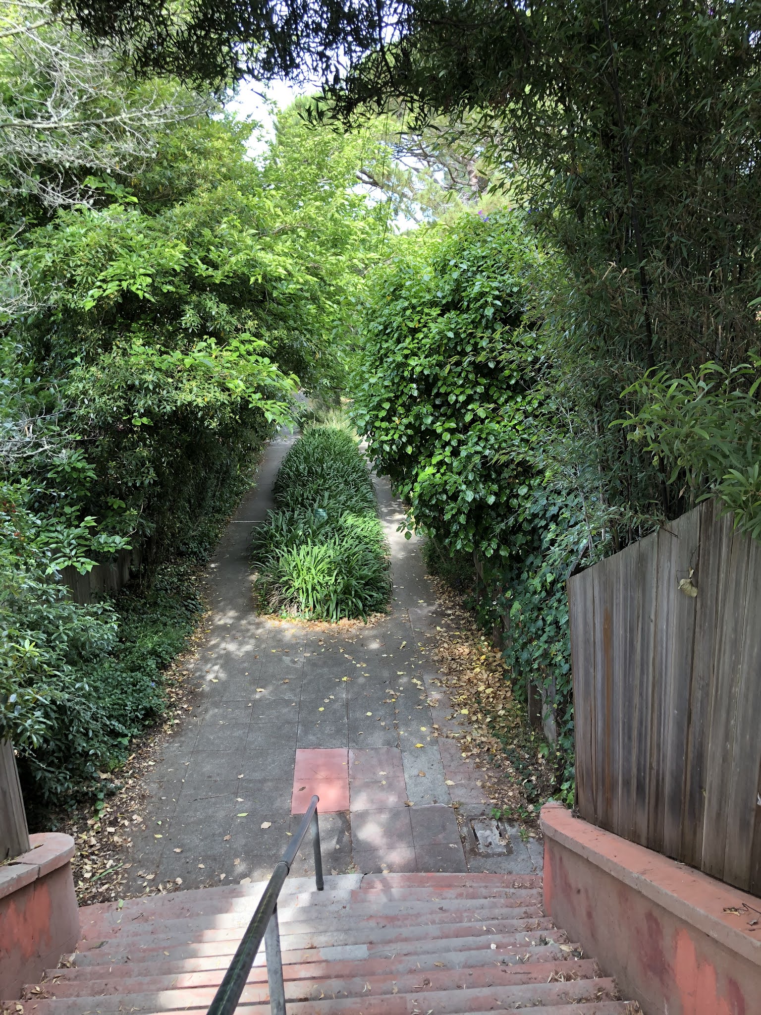
Continue downhill on Patty Kates Path at the far left side of the field.  Turn right on Woodside Rd and continue until you come to the Middle section of Fred Herbert Path on the left.  

Middle Section of Fred Herbert Path

This path has 3 parts.  Take the middle section downhill (about 65 steps) to Hillview Rd.  There are 2 options now.

SHORTER hike: Cross Hillview Rd and take the Lower section of Fred Herbert Path to Wildcat Canyon Road and turn left.  Continue with instructions below at section marked WILDCAT CANYON RD. 

Lower Section of Fred Herbert Path

LONGER hike.  Go left on Hillview Rd.  When you reach Woodside turn right and go to The Crescent.  Make a left and follow The Crescent to Crescent Park Path (unmarked) on the right If you come to Park Hills Rd you've gone too far. 

Crescent Park Path Entering Crescent Park

Take this to Crescent Park.  There are Crescent park paths leading out of the park, one to the right and another straight ahead.  Take the straight ahead path back to The Crescent and turn left to park Hill Rd.


Crescent Park Path Exiting Crescent Park

WILDCAT CANYON RD. Turn right on Park Hills and go to the end at Wildcat Canyon Rd.  Turn left and follow Wildcat Canyon, with Tilden Park on the right, for about 1 mile.  You pass the Lower section of Fred Herbert Path on the left.  

Lower Section of Fred Herbert Path


Along the way you might see goats “mowing” the grass or wild turkeys. 

Goats and Sheep Mowing Grass in Tilden park


When you get to Sunset Lane turns left and go uphill on Sunset.  At the top turn right on Woodmont Avenue and continue to the right on Vistamont Ave.  You eventually come to Vistamont Trail.  

Vistamont Trail


Take it to the end and continue on the rest of Vistamont Avenue until you come to Rosemont Ave.  Turn left, continue past Woodmont and turn left on Creston Rd .  Follow Creston for a short way until you reach John Muir Path on the right. 

John Muir Path

Take this to Grizzly Peak Blvd by Keeler Ave.  Turn left on Grizzly Peak and continue to the starting point at Marin. 


Wednesday, August 19, 2020

Solano and Colusa to Kensington and Back

Difficulty: Moderate.  First part lots of uphill but all downhill after reaching Kensington

Time: 1 1/2 hour

Start heading north on Colusa from Solano.  After a few blocks, turn right on Vincente Ave.  Note, you can start on Colusa and Vincente if you want to make this a shorter hike.  After a few yards, you take El Paseo path on the right, uphill (36 steps plus ramps) to Santa Rosa Avenue.

El Paseo 


Turn left and continue on Santa Rosa past Thousand Oaks Blvd until you reach Menlo Pl.  Turn right and shortly on your left you come to Visalia Walk (Listed as Visalia Steps in some maps).

Visalia Walk/Steps


Take this downhill (about 80 steps) to Vincente Avenue.  Turn right on Vincente until you reach Vincente Walk. 

Vincente Walk


Take this uphill (88 steps) to the junction of The Alameda and Vallejo St.  Take Vallejo one block to the end  at San Ramon Ave and make a slight left to San Antonio Avenue.  Follow San Antonio to The Arlington.   Turn left and walk several blocks, passing Boynton Walk on the uphill (East) side of The Arlington until you come to the Kensington shopping district.  As you pass the gas station and Coventry Rd you come to Ardmore Path on the left.  

Ardmore Path


Take it downhill (30 steps plus ramp), cross Ardmore Rd, and continue downhill on Lower Ardmore Path to Coventry Road.  

Lower Ardmore Path


Turn left and come to Public Path 3 (aka Coventry Path).  

Public Path 3


Take this downhill (17 steps plus long ramp) to Coventry Road again and turn right.  Right before you reach Lenox Rd you come to Public Path 2 (aka Stratford Path) on the left.  

Public Path 2


Take this downhill to Stratford Rd, turn left and continue on to Coventry.  Turn right and when you get to Marchant Ct turn left.  This is a one block street with Public Path 1 (unmarked) on the left.  

Public Path 1


Take this dirt road downhill back to Coventry.  Turn right and continue down Coventry until you get to Berkeley Park Rd.  Turn left and take this to Colusa .  Turn left on Colusa and go for several blocks until you return to the starting point.   Note the interesting rock you pass on the left.

Rock on Colusa


Tuesday, August 18, 2020

Down Marin From Hilldale

Difficulty:  Hard, many up and down paths and roads

Time: 1 ¼ hours

Starting at Hilldale Ave and Euclid Ave, head downhill on Marin, past Spruce St,  until you come to Santa Barbara Rd.   Turn right, make an immediate left onto Indian Rock Ave and take this to San Luis Rd.  Turn right and go several  blocks and you will see Upton Lane on the left.  

Upton Lane


Take it downhill (40 steps) to San Diego Rd.   Turn right and follow San Diego Rd to Southampton Ave and turn right.  Follow Southampton, passing Turnbridge Lane on the left until you get to Chester Lane on the left.  

Chester Lane


Take this uphill (ramp) to San Luis Rd and turn left.  Continue for about 400 yards until you get to Santa Barbara Path on the right.  

Santa Barbara Path


Take it uphill (17 steps plus ramps) to Santa Barbara Rd and turn left.   Follow Santa Barbara Rd to The Arlington and turn right.  Go a short way before you come to Boynton Walk on the right.  

Boynton Walk


Take it uphill (35 steps) to Boynton Ave .  Cross to the east side of the street and go left until you see Maryland Walk on the right.  

Maryland Walk


Take it uphill (about 70 steps) to Vermont Ave.  Turn right and in a few yards make a left onto Maryland Ave.  Follow Maryland past Michigan Ave until you reach Kentucky Ave.  Make a right, go a short way and then take Holmes Path on the left uphill (12 steps) to Vassar Ave. 

Holmes Path


Turn right on Vassar and take it to Spruce St.  Cross to the east side of Spruce and go right a short way, past Dorthy M Bolte Park to Acacia Steps.  

Dorothy M Bolte Park

Acacia Steps


Take it  uphill (90 steps) to Cragmont Ave.  Turn left on Cragmont and go about 150 yards and come to North Path on the right.  

North Path


Take this uphill (70 steps) to Euclid Ave.  Cross the street and head right for about 350 to 400 yards until you come to Upper Halkin Walk.

Upper Halkin Walk

Upper Halkin  Walk


Take it uphill (about 165 steps) to Hilldale Ave.  Turn right and got to the starting point at Marin Ave.


Saturday, August 15, 2020

Between Rose Garden and Campus

Difficulty: Moderate, some uphill climbs

Time:  1 hour

_____________________________________________________

Start at Scenic Ave and Vine St and head north on Scenic to Hawthorne Steps.   

Hawthorne Steps


Take it uphill (52 steps) to Hawthorne Terr and turn left and head to Euclid Ave.  Turn left on Euclid and go to Rose Walk

Rose Walk


Take it uphill (about 40 steps plus ramp) .  At the top, go left and head uphill on Rose St.  At the top of Rose St on the right, go uphill on Rose Steps (no sign) to La Loma Ave.  

Rose Steps


Turn right on La Loma and head downhill.  When you get to Cedar St, cross La Loma and take Cedar Path uphill (82 steps) to La Vereda Rd.   

Cedar Steps

Turn right on La Vereda.  When you get to Hilgard Path on the right, take it downhill to La Loma Ave,  turn left and go to Virginia St. Alternatively continue on La Vereda to La Vereda Steps (no sign) and take it downhill (68 steps) to La Loma, turn right and then after a few feet, turn left on Virginia.

View from Bottom of Hilgard path


La Vereda Steps


Follow Virginia St to Le Roy Ave and turn right.  Take LeRoy Walk uphill (41 steps) to Hilgard Ave.  Note, these steps are named LeRoy Steps at the top.  Turn left on Hilgard and head to Euclid

LeRoy Walk/Steps


On Euclid Ave turn right, cross Cedar St and turn right on Hill Ct.  At the end of the block on the left, take Hill Ct Steps uphill (21 steps) to Le Roy Ave.   

Hill Ct Steps


Turn left,  go to Buena Vista Way, turn right and head to La Loma Steps on the left.  

La Loma Steps


Take this downhill (44 steps) to the junction of Le Roy Ave and Hawthorne Terr.  Take Hawthorne to Euclid, turn left,  and go to Vine Lane.  

Vine Lane

Take Vine Lane downhill to Hawthorne Terr.   Cross Hawthorne and continue downhill on Vine St. for 1 block to the starting point at Scenic and Vine.


Tuesday, August 11, 2020

Claremont Ave North and South of Ashby Ave

Difficulty:  part 1 moderate, many uphill and downhill climbs: part 2 easy

Time:  part 1, 1 hour:  part 2, 30 minutes

Start at Ashby Ave and Claremont Ave and head south on Claremont.  Take Oakridge Path on the east side of Claremont. NOTE:  If the gate to Oakridge Path is locked, go a little further south on Claremont to Hazel Rd, turn left, and take this uphill to Domingo Ave.  Turn left and follow the route below. 

Start of Oakridge Path
End of Oakridge Path


It passes through John Muir School Park to Domingo Ave.  Make a left and go a short way to El Camino Real and turn right.  When you get to Park Path on the left, take it uphill (46 steps plus long ramp) to Oak Ridge Rd and turn right.

Park Path


Take it to the end where you get to Oakridge Steps on the right. 

Oakridge Steps


Take it downhill (123 steps) to El Camino Real and turn right.  You shortly come to The Cutoff on the left.

The Cutoff


Take it downhill (37 steps plus long ramp) to The Plaza Dr and turn right.  Take it for several blocks where it ends at Encina Pl.  Turn right and go a few steps to the right where you see  Encina Walk on the left side.     

Encina Walk


Take this to Oakvale Ave and continue on to the left until you come back to Claremont Ave.  Turn left and go to The Uplands, and then turn left.  When you come to The Footway on the right, take it uphill (36 steps plus long ramp) to Hillcrest Rd and turn  left.  

The Footway


Hillcrest then forks into a right and left road.  Take the left road and follow Hillcrest until you come to South Crossways on the right and Crossways  on the left.   

Crossways

South Crossways


Take Crossways down a long ramp  back to The Uplands, turn left and go back to The Footway.  Take The Footway uphill again to Hillcrest.  This time take the right road at the fork and go a short way until you reach The Steps.  

The Steps


Take this downhill (64 steps) to Hillcrest Rd again, turn right and go back to Claremont Ave.  Turn right and go back to the starting point at Ashby Ave .  You can end the hike here.  However, if you have more energy, continue on for a shorter additional hike north of Ashby.

Cross Ashby, go a few blocks north to Garber St and turn left. This runs into Garber Path.   

Garber Path


Take this downhill (40 steps)  and then continue on Garber to Piedmont Ave and turn left. When you get to Stuart Ave turn left.  At Palm Ct go a little to the left and reach Avalon Walk

Avalon Walk


Take it uphill (43 steps) to Avalon Ave.  Turn left and go a short way until you get to Pine Path on the right.

Pine Path


Take it downhill (52 steps plus ramp) to Russell St and turn left.   When you get to Oak Knoll Path on the left, take it uphill (long ramp) to Avalon Ave and turn right.  

Oak Knoll Path


Go back to Claremont Ave, turn right and go back to the starting point at Ashby.